Tuesday, July 20, 2010

Rage

Not that I'm necessarily skating along the jagged brink of disaster by posting about my life down here in Louisiana, since I'm sharing no data or observations on our data. Though I am slowly going through some of the laws concerning this. BP, which is ultimately paying for the remediation and the science work going into the natural resources damage assessment (NRDA), is doing its best to close down all public access to any relevant information.

I find this odious. I did make a brief statement on it in an earlier post, and I'm not trying to lose my job or cause anyone else to lose theirs.

However, there are laws behind this NRDA, and I'm going about reading them, to see if it's specified how much access the general public has to scientific information, both during and after the collection process. Right now we, as well as government groups like NOAA, are guarding everything pretty carefully. Unaffiliated scientists especially would love access to all of this information. (The general public might be mildlly interested, but also not as able to interpret things. The hard data's for the geeks.)

So there's a general aroma of secrecy about our work, even though we're simply monitoring the environment. And even within the operation there are sharp edges, pieces out of place and the occasional slash and bleed.

That metaphor isn't meant to imply actual injury--though those have occurred, in many phases of this remediation work--but rather, discord and interference among the different parties involved. I'm on board the Ridley again, as we steam back out toward the wellhead, having spent nearly the last full week on shore, and having spent four days before that exiled to the outer margins of the Deepwater site.

Last week, when BP opened up the damaged riser in order to fit it with a new cap, we were pushed off-site and prohibited from doing any monitoring. The chain of events was as childish and stupid as it was exasperating: local boat contractors refused to communicate with the Ridley's Filipino crew, claiming we were driving erratically and refusing to respond to radio hails.

Lies, all of it. This crew, from the captain down to the steward, is one of the best and most professional I've ever worked with. Only NOAA boats might be better, among those I've worked on, and that's only because they're more plush. (I hear Fugro ships are kind of like cruise vessels for the science crew, but I wouldn't know.) What I can say, during the time I've spent on bridge and in every interaction I've had with these guys, is that they keep a clean ship and they're very serious about their work.

But some locals didn't like their accent, didn't like how they're all business on the radio, and didn't like that this ship is flagged out of the Marshall Islands (known, along with Panama and Liberia, for its lax-to-nonexistent maritime regulation--making those three nations' flags popular to fly in the merchant marine). The local boys ganged up on the foreigner. To what extent BP was not unhappy with this, due to the opening of the wellhead, I can't say but I can say how frustrated I am.

We're here to look at the spread of oil. I realize that our work, compared to stopping the flow of oil, is right now unimportant. Shoot all the sonar we want, we have no influence on the leak, or on any decisions concerning it. Our work is exclusively for down the road.

And it's that down the road aspect which outrages me. There are possibly six or more vessels at various times doing testing and taking samples in the vicinity of the wellhead. The Ridley Thomas is one of four ships, along with NOAA's Thomas Jefferson, which does acoustics, and for most of last week, we were the only one on site. It's the acoustics, as imperfect as this application is, which can provide a large-scale view of the subsurface oil. The more our results are correlated to chemical tests, the bolder we can become with our interpretation. Gathering as much data as we can about the spread of oil below the ocean's surface is the best contribution we can make now to future science. Our best opportunity to inspect and measure the seafloor gusher last week was summarily taken away from us. Our best chance to contribute to posterity's knowledge of seafloor blowouts and current activity in general is gone.

That frustrates me.

So now BP's finally given permission, and we're going back to the wellhead, likely with the good ole boys no more kindly disposed to our crew than before, to take a few days' data before heading back to Fourchon in 84 hours.

Yes, No Complaints Club. I'm not going to stop doing my work--rather the opposite!--but I don't like being jerked around.

So here I am, on a boat being hit with a steady stream of jabs and uppercuts in the form of 4-6' waves. A new tropical wave, Invest 97 (still don't understand that Invest thing), is lurking behind Puerto Rico and bidding to make straight for us. Should be an intriguing couple of days.

I won't post a photograph, but today's snack from the kitchen is a little alarming. Donuts, which are fine--topped with what seems like Tartar sauce (smells like it too), and grated cheese.

Great time to start slimming down again, huh? To get rid of the face pudge...and the rest of the pudge, for that matter. I'm starting to look a little more like the "after" in this before-and-after picture series...and yes, it's the same guy.

Before: thin Val.
After: fat Val. Wonder
when he's due?...


Sunday, July 11, 2010

Blah Blah

Life has settled into a routine here on board ship, as you'd expect. The mantra in the offshore industry is, We strive for boring days. In other words, when the weather is good, and the equipment works well, and the crew is competent and on task, life is uneventful. Cows chewing grass.

It's been that kind of day, and if we have 10 more of these, I'll be very happy. Steady work, steady accumulation of data, and good crew relations.

Other than that, nothing to say about life on board ship. Literally. I'm not allowed to say anything else, so I won't. I trust that all of the data currently being gathered by governmental, university and private (like us) sources for the Natural Resources Damage Assessment, to be used for the spill litigation, will eventually become public domain. I believe the NRDA framework was all set up by the 1990 Oil Pollution Act, as a direct result of the 1989 Exxon Valdez spill. My URI geology advisor, the estimable Dr. B, has described working (either as a contractor or else for the Alaska state or the federal government) on an environmental damage assessment for that spill alongside several other coastal science colleagues. Only, they'd all been hired by different parties, and were not allowed to share any data or thoughts at all. They were staying in neighboring, or the same, hotels, ate and drank at the same restaurants, had drinks together...and couldn't discuss anything of what they'd been doing all day.

Now that's awkward. Dr. B's a fairly savvy guy. He's a born storyteller--one reason we get along--so he's not one of these calculating, overly concealing, close-to-the-chest types who annoy me extremely. But neither is he an oblivious brag, by any means. Dr. B knows how to parse his words and speak carefully, so I'm sure he was able to get along with his buds and not be too inappropriate. But still, it's hard to put your passion to work and devote yourself to a task, and have to clam up about it afterward. But it must be done.

But as far as the dueling environmental assessments, they're a gigantic waste of time, effort and money. They also make open fraud (in the case of Exxon trying to minimize all aspects of the spill's impact) a real and vibrant likelihood. I've yet to read the 1990 Act--I intend to--but my impression is that the NRDA for which we're gathering information is a child of that law. And I'll repeat my hope that the public will have access to this information someday. We all deserve to. This spill is on the short list of world's worst environmental disasters, along with Chernobyl, Saddam's destruction of the Kuwaiti wells, Ixtoc, the loss of the Aral Sea and the ongoing devastation of the Niger delta.

In the meantime, I'll write about quality-of-life things, and ancillary stuff like the photos I've taken to posting. It's good to spread some general contextual info, and bring people a little closer to events down here, even if the science is off-limits for a while.

Aside from that, I do still have thoughts on the outside world...like, I'll never quite recover from the Celts losing in the Finals this year. One quarter. Kobe pushed Perk from behind in Game 6, which is why he landed awkardly on his left leg and blew out his ACL. And that may have been the difference, the loss of interior defense and rebounding. This hurt worse than the Giants beating the Patriots in '08. I feel a little badly for the bengal, who became a serious fan this year (even though we dropped cable 1/4 of the way into the season and couldn't watch any more games) and in the end was faced with a very bleak conclusion to the season.

I also think LeBrand made LeCopOut by joining DaWayne down in Miami. I do think more of Dwyane (the actual spelling of his name) for helping engineer this: that guy's a real baby-faced killer of a player, with far more on- and off-court shrewdness than most. Nothing like Granddaddy Bill Russell, of course, whose practice of taking Wilt out to dinner during series and thereby dulling his competitive edge is both established fact, and legendary. (Nobody will ever surpass Bill Russell for sheer wiliness.) But Dwyane seems to be respectably comparable. He's managed to convince a better player than he is to come join his team and be second fiddle. How about them apples!

As for LeBlah...I don't care if his team wins four, five, or eight championships. He gave up on himself.

On to some pictures!


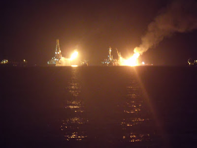
I couldn't resist some nighttime shots, even despite the blurriness.

Even worse, but the lights on these drill rigs and ships are pretty spectacular.

Check out the smoke from the oil/gas flare, lit by the flare itself.

Saturday morning (July 10), a much clearer, less hazy day. From 10 km, where I took this shot, you'd've seen only impenetrable blue-gray haze on Friday.

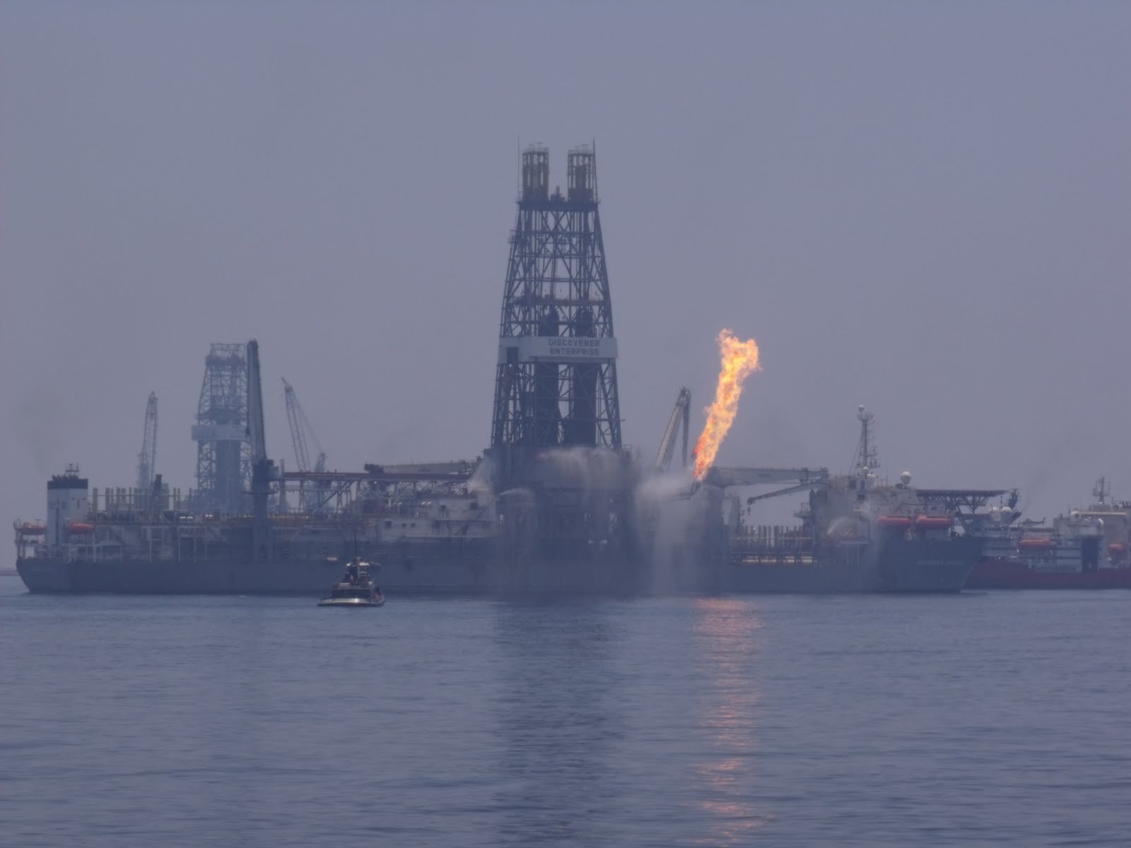
A little closer in. That flare is just mean-looking. I read that the gas flares on platforms off of West Africa are so big and so fierce that the workers stationed there sleep in their fireproof suits.

City of Ships, from a distance.

Northwestern corner of the City, with the nearby Loch Rannoch ready to start receiving oil. BP is switching caps on the damaged well today, from the awkward, inefficient first-generation cap to a better-fitting and more permanent second generation cap which is predicted to be able to capture all of the outpouring gas and oil. We'll see.

Southern portion of the City, with the Q4000 and its oil/gas flare, and the DDII a bit to the right of that. Behind the DDII is the rising plume of smoke--hazy blue in the distance--from a surface oil burn, on the Gulf itself, miles away.

The closest I've come to an American morning snack yet--though it's about 3 in the afternoon. The cooks made donuts, but then decorated them with chocolate and, it looks like, peanuts. I scraped off the chocolate and peanuts and was left with a not-half-bad donut. Not quite as sweet as I like 'em (and I do enjoy plain donuts), but far from bad. And that's genuine coffee. From-the-bean, brewed coffee. Matt and I have come to depend on the little stash in the processing room.

Friday, July 9, 2010

Spectacular and Awful

Our first day on the site, and we spent slightly less than half of it surveying. Our morning was occupied with routine safety, muster and abandon-ship drills, and then waiting for permission to enter the 5 nautical mile exclusion zone and begin working close to the rigs. And once we got permission, in we went.

As ever, part of me was eager to be a gawking touristy little boy, so I put my digital camera to use. Here's a selection:


The legendary A-Whale. This thing was apparently, as of late April, going to be just another run-of-the-mill supertanker, until the Deepwater blew up. Then its builders decided to convert it into a skimmer, which swallows polluted water at the bow, separates oil from water, and spits cleaned water (pretty clean, anyway) out the stern. They completed the conversion in two months. That, to me, is amazing. For the record, I have no idea if the A-Whale will remotely live up to its billing, and the scale of this spill is orders of magnitude beyond the capacity of all the world's skimmers, but hey, if you've got it, use it.

(And that applies to us and our sonar, too. Check out these apples!)

Smaller skimmers at work. Two boats haul a section of boom between them, and one boat pumps in fouled surface water. Unlike the A-Whale, the small skimmers have to haul the oily water to shore, where it's separated. A much less efficient process.

The skimmer again, closer up.

Oil in the water. It's all over the place near the well.

As the oil gets thicker, and goes from being a sheen-type slick to being mousse, it takes on a somewhat crusty look atop the water...and it also turns the foam brown.

One of the dozens of support vessels in the area which we had to navigate around. Those helipads over the bridge are fairly common among larger oilfield vessels--can't do anything good for the ship's stability in a storm!

City of Ships.

Weird support vessels for specialized missions like this. What the heck is that thing on the left, with the three orange tubs on a rack? I have no idea.

The Deepwater Driller III, or DDIII. It's drilling the kill bore which is supposedly just a few feet from intersecting the runaway well. It's also SIMOPS headquarters. That thing floats on gigantuous pontoons, just like the Deepwater Horizon did, just like the DDII nearby, and just like the Thunderhorse platform a few miles away (which almost sank in a hurricane a few years ago).

Another specialized support vessel, with lots of pipes and things, and a helipad too. Duuuude!

More skimmers. A lot of these skimming/recovery vessels are locals who've volunteered or leased their boats out. We spent most of the morning listening to a few chatty skimmers, locals who were having lots of fun wasting radio airtime talking about things. They weren't using boom, though, they were using another type of tool, pompom-type absorbers which basically just sponge up oil from the water. As one said to his buddy on air, "Just dip it in the water, swish it around 3 or 4 times, pick it up and put it in the bag. It's dirty...it's fun...it's funny...it's a job!"

The Q4000, a specialized production platform. The flames are a flare for the oil it's piping up from the sea floor. I read some very intelligent analysis (from my favorite commentator Fishgrease), that BP is pulling some (surprise, surprise) very elaborate fraud by means of this vessel. Rather than carefully separate water, oil and natural gas, BP is simply flaring the mixed oil and gas in haphazard fashion. Because separating them would mean the amounts can be measured, which means that much more definite amounts emerging from the well can be calculated, which would then be entered into evidence against BP in the upcoming court battles. And BP would rather keep important details like the amount spilled as nebulous and inadmissible as possible. I write this not because it's wild speculation--it's intelligent analysis by a longtime oilfield professional.

Still, fraud or no, that flare is pretty effing cool. Or the opposite of cool--blazingly hot. It was nearly 100 outside today, and we were 1.5 km away, so I wouldn't claim to have felt any heat fro the flame. But we could hear it. It sounded like when you take the hose off of a vacuum cleaner, and listen to the air being sucked in the intake. Only, you're a mile away. That stream of water is from a fire boat, to keep the flare pipe and deck cool. When the deck heats up to about 180 degrees or so, the guys ask to be doused with water.

Stern of the Discovery Enterprise, central vessel to this whole operation, and the one from which most operations have taken place. That flare is just methane.

Q4000, from the northeast. Note the flower pattern of the flames, and the glare on the midday water!

Discovery Enterprise, starboard side, from the northeast.

Closeup of the firey petals.

That is one angry-looking flower, don't you think?

Discovery Enterprise again.

Closeup of the Enterprise flare. Looks almost quaint compared to that circular monster on the Q4000.

The two drillers, DDII (nearground, right) and DDIII (background, left) from the west.

The Loch Rannoch, a specialized tanker hooked up to the blown-out well via pipes, and collecting oil.

DDII again.

Discovery Enterprise, portside, from the south.

Vadda FHREAKING mess, ahh?!

The two flares, from a distance.

Yet another of the Discovery Enterprise.

Thursday, July 8, 2010

Mo' Photos!

What can I say? I'm a country boy. Big machines shock and awe me, so I take pictures of them. I've posted some.


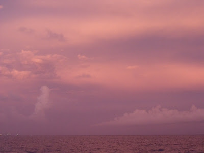
...though the machines are barely visible here, mostly a rosy post-sunset sky. I missed the sunset itself by two minutes, but the afterglow is no less amazing.

A cute little jack-up.

One of the bigger and fancier tenders you'll see. That two-tone orange and yellow color scheme, belonging to the Edison Chouest company, is a common sight: they're a bigtime contractor on the Gulf.

One half of the fabrication/staging building where tenders load up.

...the other half.

A big daddy jack-up. These things do the exploratory drilling (like the Deepwater Horizon was doing, only it was on pontoons, as it worked in much deeper water) in 300' or less of water. If the well is successfully completed, then the production company will build a stationary platform there and begin producing. But the work starts with a mobile jack-up.

Not sure what this boat does--it's not a science vessel, since those have open back decks and A-frames. It's sure not a tender, since those are basically pickup trucks. There are lots of pipes and what looks like pumping equipment on the lower deck--possibly it's associated with the cleanup effort.

Double- and triple-parking is common. You just need to cushion the boats and rig up your gangways...

The avenue.

A closeup of the avenue...those big spools in the center of the picture are on the order of ten feet in diameter.

Gators & Rain

Louisana is the land of bayous. The whole southern part of the state is a swamp, with various portions built up to support roads and buildings. I haven't asked, but I'm guessing that almost everything built down here has been built on fill, since there are large, wide ditches between most roads and the yards of houses alongside them, as if some earth needed to be scooped up to create the drier land. At the very least--where fill was needed and where it wasn't--the water table isn't far below. On this most recent drive down to Fourchon, one of those road-yard ditches was overfull, and the houses' yards were underwater. The standing pond reached the doorstep of most houses along the way. I saw two kids playing in a rowboat in their front yard.

And where there's water, there are gators. Not to mention, where there's forest or underbrush, and yes, water, there are snakes. I'm starting to learn my snakes, to distinguish markings of the poisonous ones from the non-poisonous (and yes, some are quite similar. Nature has its mimics). But the main danger is from gators, in and near the water.
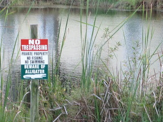
I was told, two years ago in Cameron, that there are so many gators around that I probably wouldn't make it alive from the hospital (where I'd been laid up for the night) to the port, a few miles away, by walking. It's hard to know, given the disdain many southerners feel for yankees like me, if I was being played, or if alligators are really that present a danger. Then there are the signs:


There's one like that at the roadside ditch separating the BP command center in Houma from the highway. (I'd photo it but I don't want to risk being tackled and jailed.) A drainage ditch, 20' wide, with an alligator warning. Is that just an inside joke or what? I guess not, but I just don't have much experience down here, so I'll take the warnings seriously.

Gators: there where you least expect them. If my coffee had weeds in it I'd probably leave the cup alone.

Then there's the rain. Warm air holds lots of moisture, and it's powerfully warm down here. Blue sky, with or without white clouds, is common. But just as common is building gray, when the moisture gathers into giant clouds which sweep in and deluge the area with pounding rain for minutes or the better part of an hour at a time. I've found it useful to keep a jacket with me at all times, sort of like how people keep breath mints handy. You just never know when you'll need it, you know?